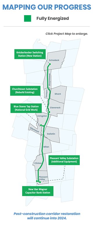
Project Maps
The NYES project is replacing aging infrastructure along a 54-mile existing utility corridor through 11 towns in Rensselaer, Columbia and Dutchess counties. The color-coded map below provides an overview of our progress along the corridor and will be updated on a regular basis. The Google map will allow you to view the entire corridor and see what’s planned in each area. You can search for and view your own property in relation to the transmission line. You can also click on the new transmission structures to see their heights. To view similar maps on a town-by-town basis, please click here.